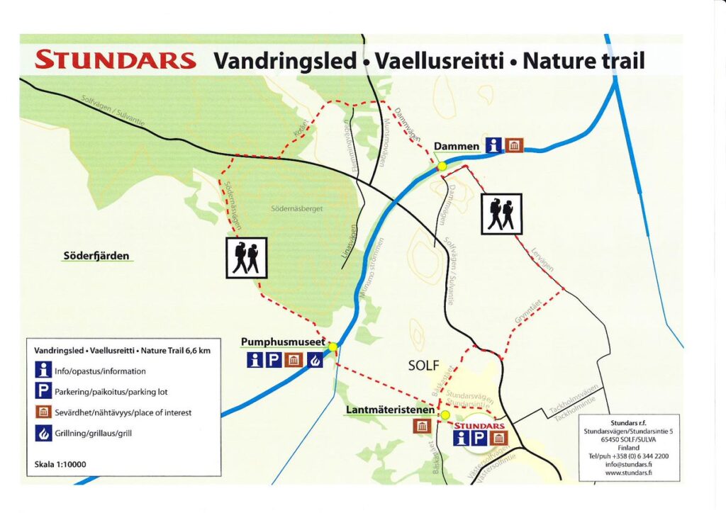
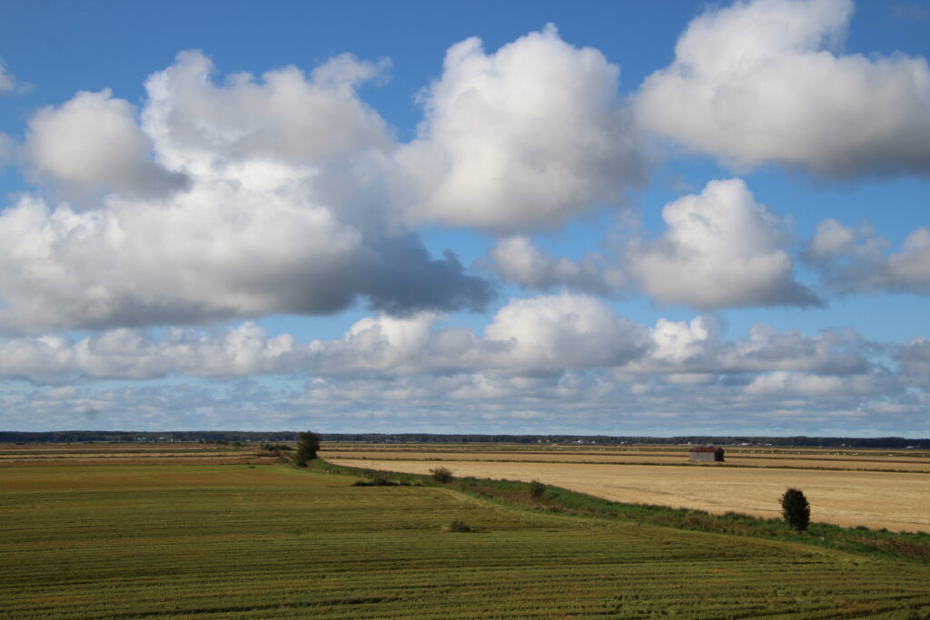
Stundars’ hiking trail is 6.6 kilometre long and follows the rim of the beautiful and rare Söderfjärden meteor crater. Here you can let your eyes wander free over fields and meadows, that only a hundred years ago still were an almost completely round sea bay, filled with reeds and fish. The trail also goes along picturesque gravel roads through a cultural environment formed on top of the traces of the latest Ice Age.
The conditions of the trail Topp
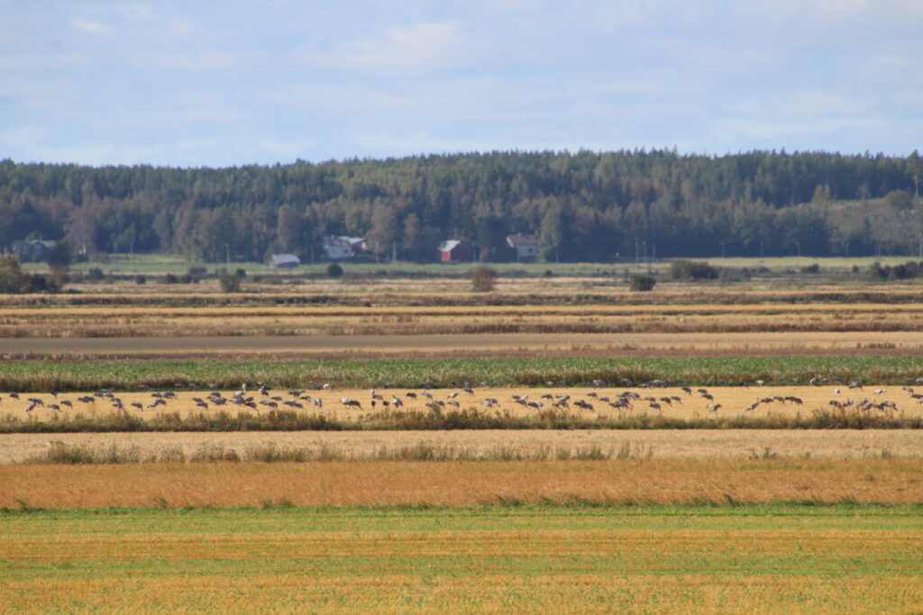
The Stundars’ hiking trail provides numerous beautiful views, clad in the colours of the season. During spring and autumn, Söderfjärden is one of the most popular pit stop in the Nordic countries for thousands of cranes, swans and geese on their long flights to and from the breeding grounds further north. The hiking trail passes an observation tower, and the most air traffic happens during early mornings and late evenings in May and September. Söderfjärden has an international status as an ”Important Bird and Biodiversity Area”. Along the parts of the trail that passes through the old villages of Munsmo and Solf, you can see the quaint, historical landscape with its rough stone walls and birch alleyways.
The Finnish Right of Public Access or ”Everyman’s right” includes part of the trail – but of course not gardens, yards or parking lots. Please keep your dog on a leash.
Service Topp
Along the hiking trail, about 1,5 km from Stundars’ parking lot, there is an observation tower with a good view of large parts of Söderfjärden.
Close by the observation tower, there is a wood burning camping stove (a.k.a. hobo stove) (fire pit?). Bring your own firewood. You are not allowed to make a fire when a grass or forest fire warning is in effect, as the sparks flying from them are a fire risk. There is also a barn that can shelter you from wind or rain.
The hiking trail is easy to walk, but half of it follows paths along Söderfjärden that are not suitable for strollers or wheelchairs.
Before your hike Topp
Choose your clothing according to the weather conditions, some parts of the trail might be wet or muddy. Also, the wind really gets the chance to build up over the vast plains of Söderfjärden, so take note of that.
The hiking trail passes the old pumping station, that is still in use to keep seawater from drenching part of the old meteor crater. The middle of the crater is still about a meter below sea level. Inside the pumping station, the artist Eivor Holm have painted the walls with historical scenes from the surrounding landscape.
You can park at the Stundars’ parking lot.
How to get there Topp
The Stundars’ hiking trail begins at Stundars Open-Air Museum in Solf, Korsholm. You may use Stundars’ parking lot for your car even when the museum is closed. Then you can walk through the museum village and head westwards to pass the old Soldier’s croft. Or you can choose to walk along Stundarsvägen road and follow the signs for the observation tower. The whole trail is 6.6 kilometres long and goes from Stundars to Söderfjärden, Munsmo village and back to Stundars.
In case of emergencies Topp
The address for Stundars Open-Air museum is Stundarsvägen 5, 65450 Solf.
In case of emergency, call 112.
We recommend that you use the app ”112 Suomi” to call for help, as it will automatically send your coordinates to the authorities (ambulance, fire department and police). “112 Suomi” is available at Google Play Store and Apple Store for free.
Söderfjärden’s history Topp
We recommend a visit to the Söderfjärden Meteoria visitors centre to learn more about the history of this fascinating place.